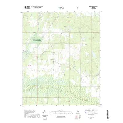
2021 Map of Bethlehem
USGS Topo · Published 2021About this map
Bethlehem and Cornersville anchor this northern Mississippi landscape, where the agricultural plains of Marshall and Benton counties meet the dense woodlands of the Holly Springs National Forest. The geography is defined by its drainages, most notably the winding path of the Little Tallahatchie River and its confluence with the Tippah River. This junction creates a complex network of wetlands and creek bottoms, including Mill Creek and Wolf Creek, which have historically dictated the placement of roads and homesteads.
Find a feature on this map
53 named features on this map. Tap any name to fly to it.
Don’t see what you’re looking for? This feature index may not catch every label — zoom into the map to look around manually.
Map Details
Editions of this 2021 Bethlehem Map
This is the sole edition of this map. No revisions or reprints were ever made.
Other maps of this area

1942 · Denmark
USGS Topo · 1:62,500

1943 · Denmark
USGS Topo · 1:62,500

1944 · Potts Camp
USGS Topo · 1:62,500

1945 · Potts Camp
USGS Topo · 1:62,500

1949 · New Albany
USGS Topo · 1:62,500

1951 · New Albany
USGS Topo · 1:62,500

1955 · Blue Mountain
USGS Topo · 1:62,500

1956 · Tupelo
USGS Topo · 1:250,000

1958 · Tupelo
USGS Topo · 1:250,000

1964 · Waterford
USGS Topo · 1:24,000