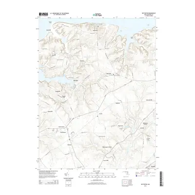
2014 Map of Betterton
USGS Topo · Published 2014About this map
Betterton sits prominently along the shoreline of the Chesapeake Bay, serving as a focal point for this survey of rural Kent County. The landscape is defined by the numerous creeks and coves that carve into the coastline, including Lloyd Creek and Still Pond Cr. Moving inland, the map reveals a deeply rooted agricultural and aviation network. Small airfields like Smith Field Airport and Harris Airport are interspersed among long-established farming communities. Several historic burying grounds, such as Still Pond Cem and Mt Olive Cem, are situated near crossroads like Catts Corner and Butlertown. The presence of numerous named crossroads—Lynch, Coleman, and Hassengers Corner—indicates a settlement pattern based on 19th-century road junctions that continued to serve as local landmarks well into the early 21st century.
Find a feature on this map
98 named features on this map. Tap any name to fly to it.
Don’t see what you’re looking for? This feature index may not catch every label — zoom into the map to look around manually.
Map Details
Editions of this 2014 Betterton Map
This is the sole edition of this map. No revisions or reprints were ever made.
Other maps of this area

1898 · Tolchester
USGS Topo · 1:125,000

1899 · Dover
USGS Topo · 1:125,000

1900 · Cecilton
USGS Topo · 1:62,500

1900 · Betterton
USGS Topo · 1:62,500

1901 · Chestertown
USGS Topo · 1:62,500

1903 · Tolchester
USGS Topo · 1:125,000

1905 · Barclay
USGS Topo · 1:62,500

1906 · Dover
USGS Topo · 1:125,000

1908 · Tolchester
USGS Topo · 1:125,000

1920 · Dover
USGS Topo · 1:125,000