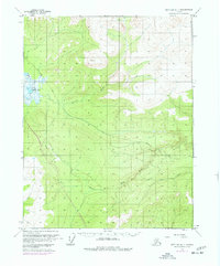
1970 Map of Bettles B-1
USGS Topo · Published 1977About this map
The Trans-Alaska Pipeline (Under Construction) cuts a definitive path through this interior landscape, documented here during its mid-1970s construction phase. The route follows the terrain southward from Olsons Lake, crossing the meandering Kanuti River and traversing the drainage of the West Fork Dall River. This survey captures a critical moment in the development of the Alaskan infrastructure, where modern industrial engineering meets a traditional network of seasonal transit. A Winter Road and various sections of Winter Trail parallel or intersect the pipeline corridor, indicating how the region was navigated before permanent all-weather roads were established. The presence of Coal Creek and numerous unnamed basins reflects the complex hydrology of this subarctic environment, which the Bureau of Land Management oversaw during this period of rapid change.
Find a feature on this map
10 named features on this map. Tap any name to fly to it.
Don’t see what you’re looking for? This feature index may not catch every label — zoom into the map to look around manually.
Map Details
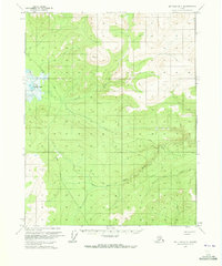
Editions of this 1970 Bettles B-1 Map
2 editions found
Other maps of this area

1951 · Bettles
USGS Topo · 1:250,000

1951 · Beaver
USGS Topo · 1:250,000

1956 · Bettles
USGS Topo · 1:250,000

1956 · Beaver
USGS Topo · 1:250,000

1964 · Beaver
USGS Topo · 1:250,000

1970 · Bettles B-2
USGS Topo · 1:63,360
1970 · Beaver C-6
USGS Topo · 1:63,360

1970 · Beaver B-6
USGS Topo · 1:63,360
1970 · Bettles C-1
USGS Topo · 1:63,360

1970 · Bettles C-2
USGS Topo · 1:63,360