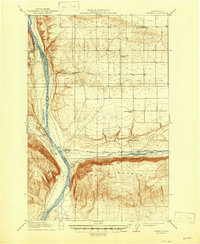
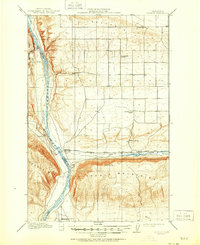
1912 Map of Beverly
USGS Topo · Published 1947About this map
The Columbia River carves a deep path through the arid landscape of Grant and Kittitas counties, serving as the primary geographical divider between the Saddle Mountains and the Frenchman Hills. This 1912 survey, reprinted in 1947, illustrates a period when the Chicago Milwaukee St Paul and Pacific railroad established a vital transportation corridor through this central Washington terrain. The rail line follows the course of Crab Creek and passes near the now-submerged site of Cohassett.
Find a feature on this map
16 named features on this map. Tap any name to fly to it.
Don’t see what you’re looking for? This feature index may not catch every label — zoom into the map to look around manually.
Map Details
Editions of this 1912 Beverly Map
6 editions found
Other maps of this area

1909 · Quincy
USGS Topo · 1:62,500

1910 · Quincy
USGS Topo · 1:62,500

1910 · Winchester
USGS Topo · 1:62,500

1911 · Red Rock
USGS Topo · 1:62,500

1912 · Beverly
USGS Topo · 1:62,500

1916 · Coyote Rapids
USGS Topo · 1:62,500

1917 · Priest Rapids
USGS Topo · 1:62,500

1920 · Colockum Pass
USGS Topo · 1:125,000

1922 · Colockum Pass
USGS Topo · 1:125,000

1936 · Hog Ranch Buttes
USGS Topo · 1:48,000