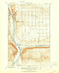
1912 Map of Beverly
USGS Topo · Published 1951About this map
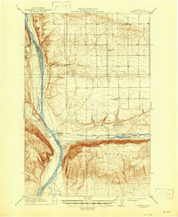
Columbia River canyon walls and the high plateaus of central Washington dominate this landscape at a time when the region was primarily shaped by the arrival of the railroad. The Chicago Milwaukee St Paul and Pacific line cuts through the center of the map, establishing the town of Beverly as a key crossing point near where Crab Creek meets the river. This rail corridor supported small ranching and farming outposts like Jericho and Eberly, which were serviced by local institutions such as Pleasant Hill School 21 and Mountain View School.
Find a feature on this map
24 named features on this map. Tap any name to fly to it.
Don’t see what you’re looking for? This feature index may not catch every label — zoom into the map to look around manually.
Map Details
Editions of this 1912 Beverly Map
6 editions found
Other maps of this area

1909 · Quincy
USGS Topo · 1:62,500

1910 · Quincy
USGS Topo · 1:62,500

1910 · Winchester
USGS Topo · 1:62,500

1911 · Red Rock
USGS Topo · 1:62,500

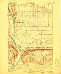
1912 · Beverly
USGS Topo · 1:62,500

1916 · Coyote Rapids
USGS Topo · 1:62,500

1917 · Priest Rapids
USGS Topo · 1:62,500

1920 · Colockum Pass
USGS Topo · 1:125,000

1922 · Colockum Pass
USGS Topo · 1:125,000

1936 · Hog Ranch Buttes
USGS Topo · 1:48,000