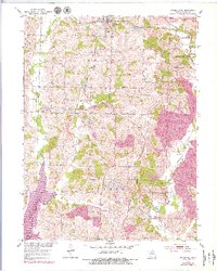
1953 Map of Bevier South
USGS Topo · Published 1979About this map
Bevier and its surrounding coal-rich landscape dominate this survey, which captures the industrial character of southern Macon County during the mid-20th century. The map reveals an extensive network of extractive industry, with numerous Strip Mine operations and mine sites scattered between the rural settlements of Keota, Ardmore, and Binkley. The local economy is further illustrated by the presence of the Bevier and Southern and Chicago Burlington and Quincy railroads, which facilitated the movement of goods through the region.
Find a feature on this map
28 named features on this map. Tap any name to fly to it.
Don’t see what you’re looking for? This feature index may not catch every label — zoom into the map to look around manually.
Map Details
Editions of this 1953 Bevier South Map
2 editions found
Other maps of this area

1908 · Atlanta
USGS Topo · 1:62,500

1908 · Macon
USGS Topo · 1:62,500

1910 · Macon
USGS Topo · 1:62,500

1937 · Elmer
USGS Topo · 1:48,000

1942 · Elmer
USGS Topo · 1:62,500

1953 · Moberly
USGS Topo · 1:250,000

1953 · Bevier South
USGS Topo · 1:24,000

1953 · College Mound
USGS Topo · 1:24,000

1953 · Prairie Hill
USGS Topo · 1:24,000

1953 · Lagonda
USGS Topo · 1:24,000