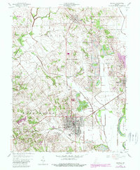
1958 Map of Bicknell
USGS Topo · Published 1988About this map
The White River defines the eastern edge of this landscape, where the Pennsylvania railroad services the riverfront community of Edwardsport. Moving west into the interior, the settlement of Bicknell serves as a central hub of activity, surrounded by the industrial scars of extensive Strip Mine operations. The rural landscape between Freelandville and Bethel is defined by an intricate network of drainage systems, including Pollard Ditch and Tilley Ditch, which reflect a history of coordinated land management for agriculture. For those researching local families, several small burial grounds are documented, including Walker Cem, Chambers Cem, and Clure Cem. The northern reaches are anchored by the Yokum Woods State Wildlife Area, while the terrain rises toward Scudder Hill, offering a clear view of the transition from industrial mining zones to managed wetlands and timbered tracts.
Find a feature on this map
31 named features on this map. Tap any name to fly to it.
Don’t see what you’re looking for? This feature index may not catch every label — zoom into the map to look around manually.
Map Details
Editions of this 1958 Bicknell Map
3 editions found
Other maps of this area

1942 · Fritchton
USGS Topo · 1:24,000

1943 · Carlisle
USGS Topo · 1:24,000

1943 · Oaktown
USGS Topo · 1:24,000

1943 · Sandborn
USGS Topo · 1:24,000

1943 · Bicknell
USGS Topo · 1:24,000

1943 · Plainville
USGS Topo · 1:24,000

1944 · Bucktown
USGS Topo · 1:24,000

1944 · Fritchton
USGS Topo · 1:24,000

1944 · Washington
USGS Topo · 1:24,000

1944 · Wheatland
USGS Topo · 1:24,000