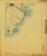
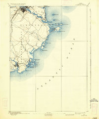
1893 Map of Biddeford
USGS Topo · Published 1905About this map
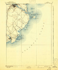
Biddeford and Kennebunkport anchor this late 19th-century coastal survey, reflecting a maritime landscape defined by shifting river mouths and established rail corridors. The Boston and Maine Railroad Western Division and its Eastern Division cut through the interior, facilitating the region's industrial connection to the wider New England network. Along the shore, the complexity of the Maine coastline is evident in the cluster of islands near the harbor entrance at Cape Porpoise and the sheltered waters of Biddeford Pool. Navigational landmarks like Wood Island Light and Goat Island Light overlook the Atlantic Ocean, signaling the era's reliance on coastal trade and fishing. Smaller settlements such as Camp Ellis and Oak Ridge appear alongside the winding courses of the Saco River and Batson River, illustrating the historical distribution of York County's population before modern expansion.
Find a feature on this map
41 named features on this map. Tap any name to fly to it.
Don’t see what you’re looking for? This feature index may not catch every label — zoom into the map to look around manually.
Map Details
Editions of this 1893 Biddeford Map
7 editions found
Other maps of this area

1891 · Portland
USGS Topo · 1:62,500

1891 · Biddeford
USGS Topo · 1:62,500

1891 · Kennebunk
USGS Topo · 1:62,500

1891 · Buxton
USGS Topo · 1:62,500

1892 · Buxton
USGS Topo · 1:62,500

1893 · Kennebunk
USGS Topo · 1:62,500

1893 · York
USGS Topo · 1:62,500

1893 · Biddeford
USGS Topo · 1:62,500

1893 · Portland
USGS Topo · 1:62,500

1893 · Casco Bay
USGS Topo · 1:62,500