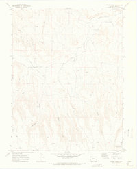
1969 Map of Bieser Creek
USGS Topo · Published 1973About this map
Little Dolores River winds through the northern reaches of this Mesa County landscape, marking a terrain defined by deep drainages and intermittent water sources. The 1968 photogrammetric survey captures a rural environment where infrastructure is limited to a network of jeep trails and unimproved roads, such as the winding Canyon Trail. Educational history is anchored by the Coates Creek Sch located near the western edge of the quadrangle. The map details a landscape where vital water access points like Toms Canyon Spring, McGinley Spring, and various unnamed springs were essential for land use. Significant topographic features include the prominent Kings Canyon and the branching Middle Briar Canyon, while industrial activity is represented by a small Gravel Pit near the river.
Find a feature on this map
19 named features on this map. Tap any name to fly to it.
Don’t see what you’re looking for? This feature index may not catch every label — zoom into the map to look around manually.
Map Details
Editions of this 1969 Bieser Creek Map
3 editions found
Other maps of this area

1885 · East Tavaputs
USGS Topo · 1:250,000

1885 · La Sal
USGS Topo · 1:250,000

1954 · Mt. Waas 1 NE
USGS Topo · 1:24,000

1954 · Mt. Waas 1 SE
USGS Topo · 1:24,000

1954 · Coates Creek
USGS Topo · 1:62,500

1956 · Westwater 4 SE
USGS Topo · 1:24,000

1956 · Moab
USGS Topo · 1:250,000

1956 · Grand Junction
USGS Topo · 1:250,000

1959 · Grand Junction
USGS Topo · 1:250,000

1959 · Moab
USGS Topo · 1:250,000