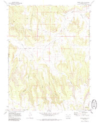
1969 Map of Bieser Creek
USGS Topo · Published 1985About this map
Little Dolores River and its numerous tributaries dominate this high-desert landscape in western Colorado, surveyed in the late 1960s. The area is defined by a complex network of drainage systems, including the branching corridors of Bieser Creek, Coates Creek, and Nelson Creek. Small-scale infrastructure from the era is sparse but notable, with the Coates Creek Sch and a local Gravel Pit serving as markers of the area's modest rural development.
Find a feature on this map
19 named features on this map. Tap any name to fly to it.
Don’t see what you’re looking for? This feature index may not catch every label — zoom into the map to look around manually.
Map Details
Editions of this 1969 Bieser Creek Map
3 editions found
Other maps of this area

1885 · East Tavaputs
USGS Topo · 1:250,000

1885 · La Sal
USGS Topo · 1:250,000

1954 · Mt. Waas 1 NE
USGS Topo · 1:24,000

1954 · Mt. Waas 1 SE
USGS Topo · 1:24,000

1954 · Coates Creek
USGS Topo · 1:62,500

1956 · Westwater 4 SE
USGS Topo · 1:24,000

1956 · Moab
USGS Topo · 1:250,000

1956 · Grand Junction
USGS Topo · 1:250,000

1959 · Grand Junction
USGS Topo · 1:250,000

1959 · Moab
USGS Topo · 1:250,000