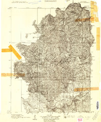
1909 Map of Big Bar
USGS Topo · Published 1909About this map
South Fork Trinity River winds through this 1909 survey, carving a complex drainage system through the Northern California wilderness. The terrain is defined by prominent elevations such as Thompson Peak and Ironsides Mtn, while Hayfork Creek serves as a major tributary in the southern reaches. The landscape shows a region before modern infrastructure, where landmarks like the Natural Bridge and Keystone Meadows provided the primary navigational reference points for early travelers and surveyors. This map was surveyed shortly after the turn of the century by J.P. Harrison, documenting the drainage patterns and peaks such as Banker Mtn that shaped the movement of early settlers and miners through Trinity County. The intricate contour work illustrates the sheer verticality of the peaks and the deep incisions of the river forks that isolated this territory for generations.
Find a feature on this map
24 named features on this map. Tap any name to fly to it.
Don’t see what you’re looking for? This feature index may not catch every label — zoom into the map to look around manually.
Map Details
Editions of this 1909 Big Bar Map
2 editions found
Other maps of this area

1886 · Shasta
USGS Topo · 1:250,000

1890 · Red Bluff
USGS Topo · 1:250,000

1894 · Red Bluff
USGS Topo · 1:250,000

1894 · Shasta
USGS Topo · 1:250,000

1909 · Big Bar
USGS Topo · 1:96,000

1913 · Weaverville
USGS Topo · 1:125,000

1914 · Pilot Creek
USGS Topo · 1:62,500

1915 · Big Bar and Vicinity
USGS Topo · 1:250,000

1918 · Anada
USGS Topo · 1:62,500

1922 · China Flat
USGS Topo · 1:62,500