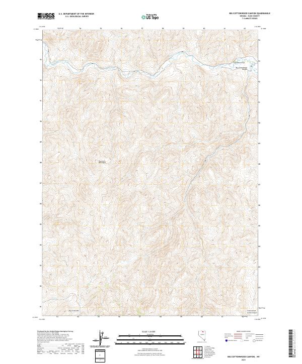
2021 Map of Big Cottonwood Canyon
USGS Topo · Published 2021About this map
The South Fork Owyhee River carves through this northern Elko County landscape, defining the northern boundary of the Tuscarora Mountains. This high-elevation terrain is characterized by dramatic shifts in relief, most notable in the deep incisions of Big Cottonwood Canyon and Cottonwood Creek Canyon to the south. The river valley provides a brief respite from the surrounding peaks at Swimmers Flat, a rare pocket of level ground in an otherwise formidable geologic province. Public Land Survey System boundaries, including t41n r50e and t42n r51e, frame the topography, which rises toward the prominent summit of Dry Creek Mtn. The intermittent drainage of Dry Cr reflects the arid character of the Great Basin, where water is the primary architect of the canyons and flats encountered across these ranges.
Find a feature on this map
14 named features on this map. Tap any name to fly to it.
Don’t see what you’re looking for? This feature index may not catch every label — zoom into the map to look around manually.
Map Details
Editions of this 2021 Big Cottonwood Canyon Map
This is the sole edition of this map. No revisions or reprints were ever made.
Other maps of this area

1955 · McDermitt
USGS Topo · 1:250,000

1956 · Tuscarora
USGS Topo · 1:62,500

1956 · Mt. Blitzen
USGS Topo · 1:62,500

1956 · Bull Run
USGS Topo · 1:62,500

1959 · McDermitt
USGS Topo · 1:250,000

1964 · Wilson Reservoir
USGS Topo · 1:62,500

1982 · Bull Run Mts
USGS Topo · 1:100,000

1982 · Tuscarora
USGS Topo · 1:100,000
1987 · Cottonwood Peak
USGS Topo · 1:24,000
1987 · Toe Jam Mountain
USGS Topo · 1:24,000