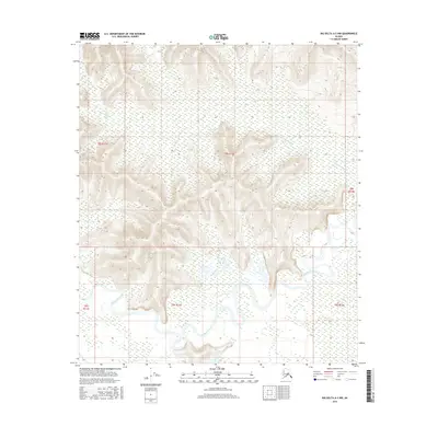
2016 Map of Big Delta A-3 NW
USGS Topo · Published 2016About this map
Goodpaster River meanders across the southern portion of this interior landscape, marking a significant hydrological feature within the Unorganized Borough. The river is flanked by an extensive network of wetlands and low-lying floodplains that dominate the southern half of the quadrangle. In contrast, the northern terrain rises into complex upland ridges, where Liseum Slough cuts through the marshy lowlands to the west. This 2016 survey, produced by the U.S. Geological Survey, illustrates the raw drainage patterns of the Alaskan wilderness before any significant human development or infrastructure altered the natural course of its waterways. The map is a study in natural topography, showing the sharp transition from the riparian environment of the river valley to the steep contouring of the interior highlands.
Find a feature on this map
8 named features on this map. Tap any name to fly to it.
Don’t see what you’re looking for? This feature index may not catch every label — zoom into the map to look around manually.
Map Details
Editions of this 2016 Big Delta A-3 NW Map
This is the sole edition of this map. No revisions or reprints were ever made.
Other maps of this area

1950 · Big Delta
USGS Topo · 1:250,000

1950 · Big Delta A-4
USGS Topo · 1:63,360

1950 · Big Delta B-4
USGS Topo · 1:63,360

1951 · Big Delta
USGS Topo · 1:250,000

1952 · Big Delta A-4
USGS Topo · 1:63,360

1953 · Big Delta B-4
USGS Topo · 1:63,360

1955 · Big Delta A-3
USGS Topo · 1:63,360

1958 · Big Delta B-3
USGS Topo · 1:63,360

1958 · Big Delta
USGS Topo · 1:250,000
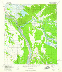
1959 · Big Delta A-4
USGS Topo · 1:63,360