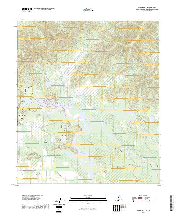
2024 Map of Big Delta A-4 NE
USGS Topo · Published 2024About this map
Big Delta sits at a critical hydrologic junction where the wide Tanana River meets the winding Goodpaster River. This interior Alaskan landscape is defined by the braided water systems of the Goodpaster Flats and the distinct elevation of Bluff Cabin Ridge. The geography shows a transition from the wetland-rich lowlands of Mason Narrows and Liscum Slough to the higher ground of Fourmile Hill. Transportation routes like the Tanana Loop Extension and New Hope Road indicate the modern footprint of settlement south of the rivers, while the northern terrain remains dominated by drainages like Rapid Creek and Progressive Creek. The proximity of Bluff Cabin Lake to the river narrows suggests a landscape historically shaped by both seasonal water flow and the navigational needs of the Tanana valley.
Find a feature on this map
20 named features on this map. Tap any name to fly to it.
Don’t see what you’re looking for? This feature index may not catch every label — zoom into the map to look around manually.
Map Details
Editions of this 2024 Big Delta A-4 NE Map
This is the sole edition of this map. No revisions or reprints were ever made.
Other maps of this area

1950 · Big Delta
USGS Topo · 1:250,000

1950 · Big Delta A-4
USGS Topo · 1:63,360

1950 · Big Delta B-4
USGS Topo · 1:63,360

1951 · Big Delta
USGS Topo · 1:250,000

1952 · Big Delta A-4
USGS Topo · 1:63,360

1953 · Big Delta B-4
USGS Topo · 1:63,360

1955 · Big Delta A-3
USGS Topo · 1:63,360

1958 · Big Delta B-3
USGS Topo · 1:63,360

1958 · Big Delta
USGS Topo · 1:250,000
1959 · Big Delta A-4
USGS Topo · 1:63,360