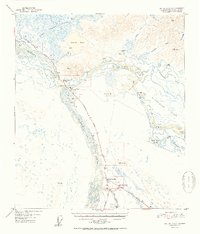
1952 Map of Big Delta A-4
USGS Topo · Published 1952About this map
The Tanana River and Delta River converge in this 1952 topographic survey, marking a vital interior crossroads where the Richardson Highway meets the Alaska Highway. This era represents a period of significant transition for the region, illustrated by the presence of Delta Junction and Buffalo Center alongside the older site of Big Delta (Aban'd). The landscape is dotted with early service points for travelers, including Bert & Marys Roadhouse and the Lost Lake Roadhouse, which were essential stops along these remote northern corridors.
Find a feature on this map
39 named features on this map. Tap any name to fly to it.
Don’t see what you’re looking for? This feature index may not catch every label — zoom into the map to look around manually.
Map Details
Editions of this 1952 Big Delta A-4 Map
2 editions found

Other maps of this area

1949 · Big Delta B-5
USGS Topo · 1:63,360

1950 · Mount Hayes
USGS Topo · 1:250,000

1950 · Big Delta
USGS Topo · 1:250,000

1950 · Big Delta A-5
USGS Topo · 1:63,360

1950 · Mount Hayes D-4
USGS Topo · 1:63,360

1950 · Big Delta A-4
USGS Topo · 1:63,360

1950 · Mount Hayes D-5
USGS Topo · 1:63,360

1950 · Big Delta B-4
USGS Topo · 1:63,360

1951 · Big Delta
USGS Topo · 1:250,000

1951 · Mount Hayes
USGS Topo · 1:250,000