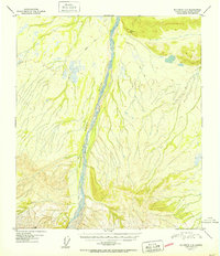
1951 Map of Big Delta A-6
USGS Topo · Published 1951About this map
The Little Delta River dominates this interior landscape, carving a wide alluvial path through the northern foothills of the Alaska Range. Surveyed just after the war in the late 1940s, the terrain is characterized by a high-altitude drainage network where seasonal glacial meltwater feeds the river's braided channels. A solitary Winter Trail provides the only evidence of human transit, cutting across the northern reaches of the quadrangle. This route likely served as a critical corridor for dog sleds or early tracked vehicles before more permanent infrastructure reached this part of the Fourth Judicial Division. Triangulation stations like Vabm Delta 1528 and Vabm Forks 3541 indicate the high points used by the U.S. Geological Survey to map this difficult terrain during the era of early aerial photogrammetry.
Find a feature on this map
4 named features on this map. Tap any name to fly to it.
Don’t see what you’re looking for? This feature index may not catch every label — zoom into the map to look around manually.
Map Details
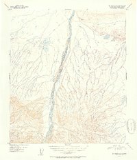
Editions of this 1951 Big Delta A-6 Map
2 editions found
Other maps of this area

1949 · Big Delta B-5
USGS Topo · 1:63,360

1949 · Big Delta B-6
USGS Topo · 1:63,360

1949 · Big Delta A-6
USGS Topo · 1:63,360

1949 · Fairbanks A-1
USGS Topo · 1:63,360

1949 · Healy D-1
USGS Topo · 1:63,360

1950 · Fairbanks
USGS Topo · 1:250,000

1950 · Mount Hayes
USGS Topo · 1:250,000

1950 · Big Delta
USGS Topo · 1:250,000

1950 · Big Delta A-5
USGS Topo · 1:63,360

1950 · Mount Hayes D-6
USGS Topo · 1:63,360