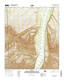
2016 Map of Big Delta A-6 SW
USGS Topo · Published 2016About this map
Little Delta River dominates this interior Alaska landscape, carving a wide path through the elevation contours of the eastern Alaska Range. This 2016 survey highlights the jurisdictional boundary between the Southeast Fairbanks Census Area and the Denali Borough, which runs vertically through the western portion of the sheet. The terrain is characterized by complex ridgelines and steep drainage patterns that feed into the river valley, illustrating the high-altitude topography of the region. As a modern US Topo product, it provides a precise technical view of the land's physical structure, emphasizing natural hydrography and public land divisions like t9s r4e and t10s r5e without the presence of modern road infrastructure or permanent settlements.
Find a feature on this map
7 named features on this map. Tap any name to fly to it.
Don’t see what you’re looking for? This feature index may not catch every label — zoom into the map to look around manually.
Map Details
Editions of this 2016 Big Delta A-6 SW Map
This is the sole edition of this map. No revisions or reprints were ever made.
Other maps of this area

1949 · Big Delta A-6
USGS Topo · 1:63,360

1949 · Fairbanks A-1
USGS Topo · 1:63,360

1949 · Healy D-1
USGS Topo · 1:63,360

1950 · Fairbanks
USGS Topo · 1:250,000

1950 · Mount Hayes
USGS Topo · 1:250,000

1950 · Big Delta
USGS Topo · 1:250,000

1950 · Mount Hayes D-6
USGS Topo · 1:63,360

1951 · Healy
USGS Topo · 1:250,000

1951 · Big Delta
USGS Topo · 1:250,000

1951 · Mount Hayes
USGS Topo · 1:250,000