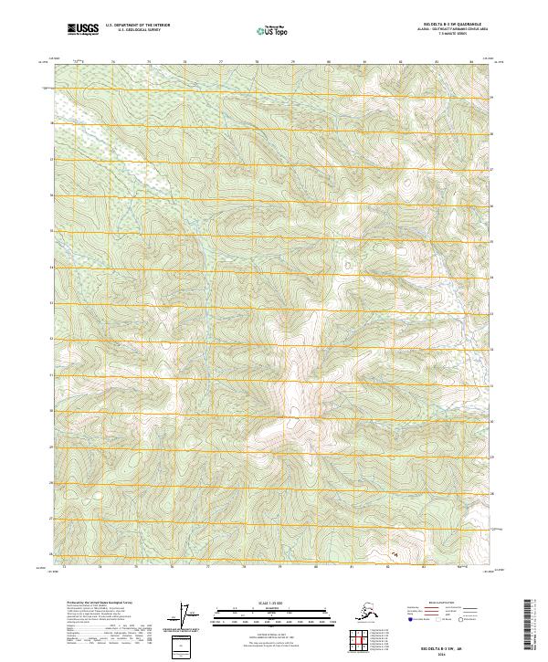
2024 Map of Big Delta B-3 SW
USGS Topo · Published 2024About this map
Shaw Creek Dome dominates the central landscape of this Southeast Fairbanks interior region, standing as a prominent landmark amidst the undulating terrain. The hydrology is defined by the drainage systems of Corila Creek in the northwest and Sand Creek in the east, both of which navigate the complex elevations of the Tanana River valley watershed. This 2024 data represents a contemporary view of the Alaskan wilderness, showing the persistent natural features that have guided travelers and surveyors through this part of the Big Delta region for decades. The map clearly delineates the township and range boundaries, including sections of t7s r12e and t6s r12e, providing a precise grid for modern land management and geographical study in this sparsely populated wilderness.
Find a feature on this map
12 named features on this map. Tap any name to fly to it.
Don’t see what you’re looking for? This feature index may not catch every label — zoom into the map to look around manually.
Map Details
Editions of this 2024 Big Delta B-3 SW Map
This is the sole edition of this map. No revisions or reprints were ever made.
Other maps of this area

1950 · Big Delta
USGS Topo · 1:250,000

1950 · Big Delta A-4
USGS Topo · 1:63,360

1950 · Big Delta B-4
USGS Topo · 1:63,360

1951 · Big Delta
USGS Topo · 1:250,000

1952 · Big Delta A-4
USGS Topo · 1:63,360

1953 · Big Delta B-4
USGS Topo · 1:63,360

1955 · Big Delta A-3
USGS Topo · 1:63,360

1958 · Big Delta B-3
USGS Topo · 1:63,360

1958 · Big Delta
USGS Topo · 1:250,000
1959 · Big Delta A-4
USGS Topo · 1:63,360