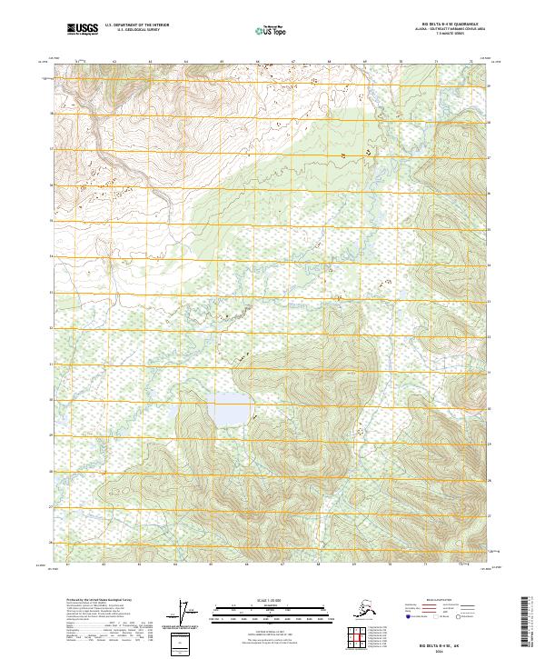
2024 Map of Big Delta B-4 SE
USGS Topo · Published 2024About this map
Shaw Creek winds through this expanse of the Southeast Fairbanks Census Area, serving as the primary hydrologic artery for the region. The landscape is defined by its complex drainage network, where Gilles Creek and Corda Creek descend from the upland elevations in the north toward the lower marshlands. A notable unnamed lake sits central to the survey, surrounded by the headwaters of Rapid Creek and Cottonwood Creek. This 2024 edition reflects the modern topography of interior Alaska, emphasizing the shifting wetlands and the intricate flow patterns of Easter Creek and Flat Creek. The map is structured by the Public Land Survey System, illustrating the township and range divisions of T6S, T7S, and T8S as they overlay this undeveloped wilderness.
Find a feature on this map
13 named features on this map. Tap any name to fly to it.
Don’t see what you’re looking for? This feature index may not catch every label — zoom into the map to look around manually.
Map Details
Editions of this 2024 Big Delta B-4 SE Map
This is the sole edition of this map. No revisions or reprints were ever made.
Other maps of this area

1950 · Big Delta
USGS Topo · 1:250,000

1950 · Big Delta A-4
USGS Topo · 1:63,360

1950 · Big Delta B-4
USGS Topo · 1:63,360

1951 · Big Delta
USGS Topo · 1:250,000

1952 · Big Delta A-4
USGS Topo · 1:63,360

1953 · Big Delta B-4
USGS Topo · 1:63,360

1955 · Big Delta A-3
USGS Topo · 1:63,360

1958 · Big Delta B-3
USGS Topo · 1:63,360

1958 · Big Delta
USGS Topo · 1:250,000
1959 · Big Delta A-4
USGS Topo · 1:63,360