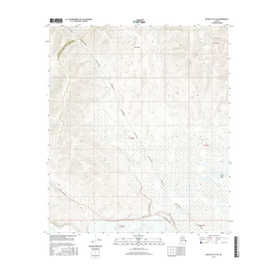
2016 Map of Big Delta B-5 SE
USGS Topo · Published 2016About this map
The Alaska Pipeline traverses this landscape diagonally from northwest to southeast, cutting a distinct path across the hills north of the Tanana River. This 2016 survey captures the vital infrastructure corridor where the pipeline parallels several interior waterways, including Minton Cr, Rosa Cr, and Keystone Cr. The southern portion of the map is dominated by the broad wetlands of the Shaw Creek Flats and the meandering course of Shaw Creek itself. Transportation in the region is anchored by the Richardson Highway, which follows the river valley, while more localized access is provided by Shaw Creek Road. A notable intersection for local navigation is identified as Old Rich @ Shaw Creek Road, suggesting historical routes or landmarks along the highway's path through this section of the Unorganized Borough.
Find a feature on this map
15 named features on this map. Tap any name to fly to it.
Don’t see what you’re looking for? This feature index may not catch every label — zoom into the map to look around manually.
Map Details
Editions of this 2016 Big Delta B-5 SE Map
This is the sole edition of this map. No revisions or reprints were ever made.
Other maps of this area

1949 · Big Delta B-5
USGS Topo · 1:63,360

1950 · Big Delta
USGS Topo · 1:250,000

1950 · Big Delta A-5
USGS Topo · 1:63,360

1950 · Big Delta A-4
USGS Topo · 1:63,360

1950 · Big Delta B-4
USGS Topo · 1:63,360

1951 · Big Delta
USGS Topo · 1:250,000

1952 · Big Delta A-5
USGS Topo · 1:63,360

1952 · Big Delta A-4
USGS Topo · 1:63,360

1952 · Big Delta B-5
USGS Topo · 1:63,360

1953 · Big Delta B-4
USGS Topo · 1:63,360