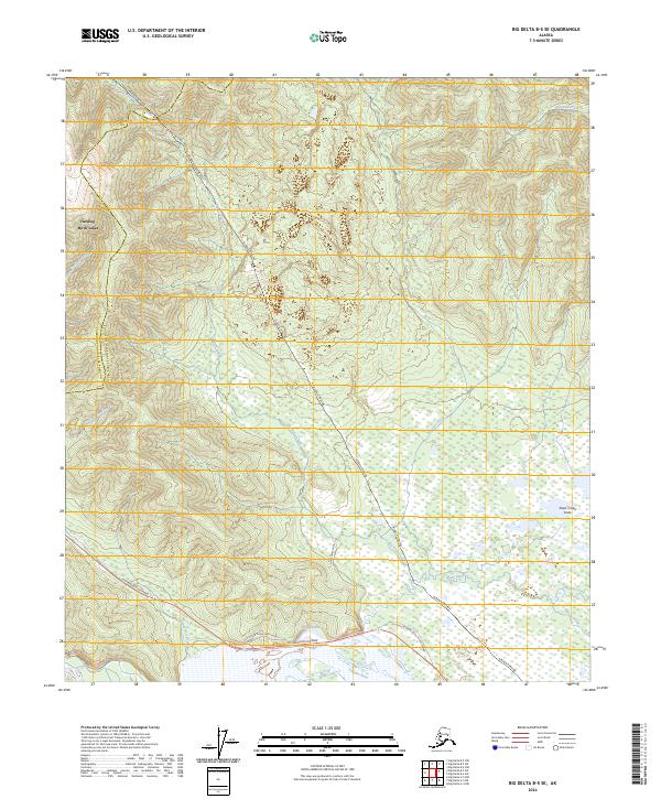
2024 Map of Big Delta B-5 SE
USGS Topo · Published 2024About this map
The Alaska Pipeline cuts a prominent diagonal across this Interior Alaska landscape, tracing a route through the hills between the Tanana River and the high country of the Harding-Birch Lakes area. This modern survey captures the vital transportation and energy corridor where the Richardson Highway meets the sprawling wetlands of the Shaw Creek Flats. The map reveals the intricate drainage patterns of the region, defined by numerous waterways such as Rosa Creek, Tenderfoot Creek, and Keystone Creek that feed into the larger river system. To the south, remnants of older infrastructure are visible in the Old Rich Shaw Creek Road and the Old Rich Shaw Creek MP 285.5 Road, which parallel the modern highway near Shaw Pond. This intersection of heavy industry, historical roadway alignments, and raw subarctic wilderness provides a clear view of how human transit is funneled through the natural breaks in the Alaskan terrain.
Find a feature on this map
22 named features on this map. Tap any name to fly to it.
Don’t see what you’re looking for? This feature index may not catch every label — zoom into the map to look around manually.
Map Details
Editions of this 2024 Big Delta B-5 SE Map
This is the sole edition of this map. No revisions or reprints were ever made.
Other maps of this area

1949 · Big Delta B-5
USGS Topo · 1:63,360

1950 · Big Delta
USGS Topo · 1:250,000

1950 · Big Delta A-5
USGS Topo · 1:63,360

1950 · Big Delta A-4
USGS Topo · 1:63,360

1950 · Big Delta B-4
USGS Topo · 1:63,360

1951 · Big Delta
USGS Topo · 1:250,000

1952 · Big Delta A-5
USGS Topo · 1:63,360

1952 · Big Delta A-4
USGS Topo · 1:63,360

1952 · Big Delta B-5
USGS Topo · 1:63,360

1953 · Big Delta B-4
USGS Topo · 1:63,360