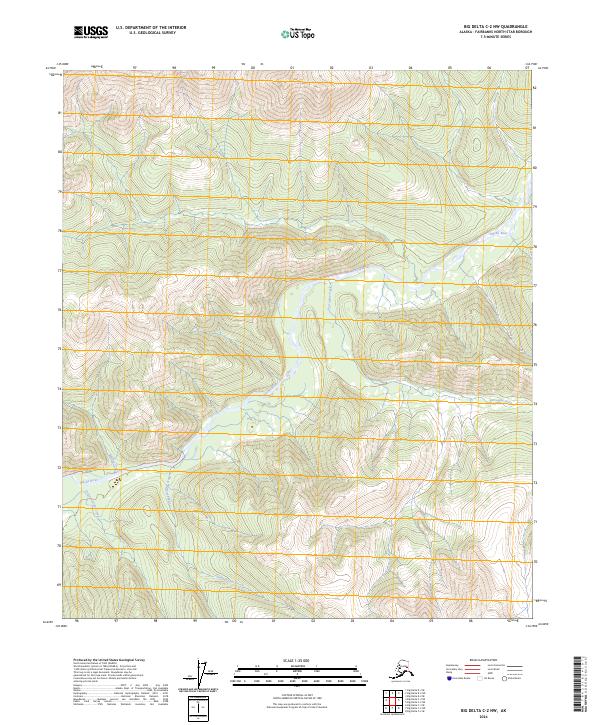
2024 Map of Big Delta C-2 NW
USGS Topo · Published 2024About this map
Salcha River drainage systems define this interior Alaskan landscape within the Fairbanks North Star Borough. The terrain is characterized by a dense network of watercourses, including the notable Porcupine Creek and Maiden Creek, which carve through the high elevations of the Big Delta region. The map provides a detailed view of the natural hydrology just before these waters reach more developed areas to the west. Evidence of the Upper Boulder Creek and Lower Boulder Creek systems shows the complex catchment area that feeds the larger river valley. This survey reflects the modern geospatial state of the Alaskan wilderness, recorded in 2024 through the U.S. Geological Survey topographic program, capturing the unchanged path of these waterways in the subarctic environment.
Find a feature on this map
9 named features on this map. Tap any name to fly to it.
Don’t see what you’re looking for? This feature index may not catch every label — zoom into the map to look around manually.
Map Details
Editions of this 2024 Big Delta C-2 NW Map
This is the sole edition of this map. No revisions or reprints were ever made.
Other maps of this area

1950 · Big Delta
USGS Topo · 1:250,000

1951 · Big Delta
USGS Topo · 1:250,000

1958 · Big Delta C-3
USGS Topo · 1:63,360

1958 · Big Delta D-3
USGS Topo · 1:63,360

1958 · Big Delta D-2
USGS Topo · 1:63,360

1958 · Big Delta C-2
USGS Topo · 1:63,360

1958 · Big Delta
USGS Topo · 1:250,000
1973 · Big Delta D-3
USGS Topo · 1:63,360
2016 · Big Delta C-3 SE
USGS Topo · 1:25,000
2016 · Big Delta D-3 SE
USGS Topo · 1:25,000