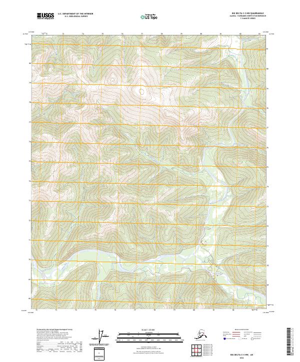
2024 Map of Big Delta C-3 NW
USGS Topo · Published 2024About this map
The Salcha River system dominates this Alaskan landscape, where the main channel meets its primary tributaries in a complex network of waterways. The confluence of the North Fork Salcha River and the South Fork Salcha River creates a dynamic hydrologic environment, most notably at the braided section known as The Splits. This area is characterized by a series of steep drainages, including Little Granite Creek and Big Granite Creek to the northeast, and Mascot Creek flowing from the central ridges.
Find a feature on this map
14 named features on this map. Tap any name to fly to it.
Don’t see what you’re looking for? This feature index may not catch every label — zoom into the map to look around manually.
Map Details
Editions of this 2024 Big Delta C-3 NW Map
This is the sole edition of this map. No revisions or reprints were ever made.
Other maps of this area

1950 · Big Delta
USGS Topo · 1:250,000

1951 · Big Delta
USGS Topo · 1:250,000

1958 · Big Delta C-4
USGS Topo · 1:63,360

1958 · Big Delta D-4
USGS Topo · 1:63,360

1958 · Big Delta C-3
USGS Topo · 1:63,360

1958 · Big Delta D-3
USGS Topo · 1:63,360

1958 · Big Delta
USGS Topo · 1:250,000
1973 · Big Delta D-3
USGS Topo · 1:63,360
2016 · Big Delta D-4 SE
USGS Topo · 1:25,000
2016 · Big Delta C-3 SE
USGS Topo · 1:25,000