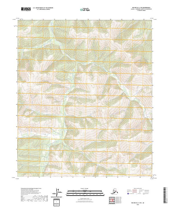
2024 Map of Big Delta C-3 SW
USGS Topo · Published 2024About this map
South Fork Salcha River winds through the interior Alaskan wilderness of the Fairbanks North Star Borough, carving a path through the steep, high-elevation terrain characteristic of the Tanana River drainage system. This 2024 edition shows a landscape defined primarily by its hydrology and relief, where Camp Creek feeds into the larger river network. The area is marked by a complete absence of developed roads or permanent settlements, representing the preserved state of the Alaska interior. The map illustrates the complex topographical features of the region, emphasizing the intricate drainage patterns that have shaped the land south of the Salcha River corridor. The lack of human infrastructure highlights the territory’s status as a remote natural environment, governed by the seasonal flow of its glacial and snow-fed waterways.
Find a feature on this map
9 named features on this map. Tap any name to fly to it.
Don’t see what you’re looking for? This feature index may not catch every label — zoom into the map to look around manually.
Map Details
Editions of this 2024 Big Delta C-3 SW Map
This is the sole edition of this map. No revisions or reprints were ever made.
Other maps of this area

1950 · Big Delta
USGS Topo · 1:250,000

1950 · Big Delta B-4
USGS Topo · 1:63,360

1951 · Big Delta
USGS Topo · 1:250,000

1953 · Big Delta B-4
USGS Topo · 1:63,360

1958 · Big Delta C-4
USGS Topo · 1:63,360

1958 · Big Delta B-3
USGS Topo · 1:63,360

1958 · Big Delta C-3
USGS Topo · 1:63,360

1958 · Big Delta
USGS Topo · 1:250,000
2016 · Big Delta C-3 SE
USGS Topo · 1:25,000
2016 · Big Delta C-3 NW
USGS Topo · 1:25,000