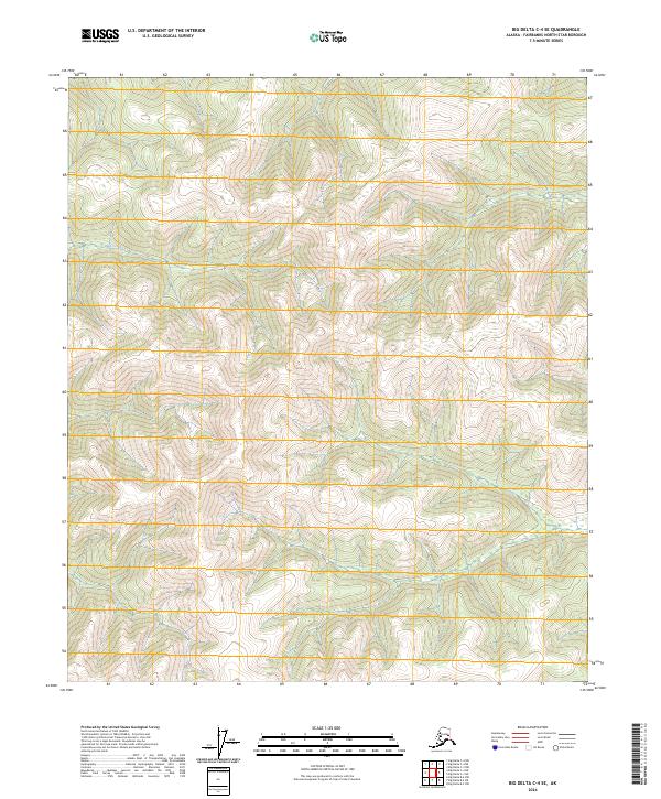
2024 Map of Big Delta C-4 SE
USGS Topo · Published 2024About this map
Deep Creek cuts through the northern reaches of this high-elevation Alaskan terrain, which is defined by a dense network of ridges and drainage basins. Located within the Fairbanks North Star Borough, the landscape is heavily shaped by the Public Land Survey System, with boundaries such as t3s r10e, t3s r11e, t4s r10e, t4s r11e, t5s r10e, and t5s r11e partitioning the interior. This topographic study emphasizes the raw hydrography and elevation of the region, providing a baseline for modern land management in a territory characterized by significant vertical relief and a lack of established road infrastructure. The map serves as a vital record of current hydrological paths and terrain contours in a largely undeveloped part of the Alaska interior.
Find a feature on this map
7 named features on this map. Tap any name to fly to it.
Don’t see what you’re looking for? This feature index may not catch every label — zoom into the map to look around manually.
Map Details
Editions of this 2024 Big Delta C-4 SE Map
This is the sole edition of this map. No revisions or reprints were ever made.
Other maps of this area

1950 · Big Delta
USGS Topo · 1:250,000

1950 · Big Delta B-4
USGS Topo · 1:63,360

1951 · Big Delta
USGS Topo · 1:250,000

1953 · Big Delta B-4
USGS Topo · 1:63,360

1958 · Big Delta C-4
USGS Topo · 1:63,360

1958 · Big Delta B-3
USGS Topo · 1:63,360

1958 · Big Delta C-3
USGS Topo · 1:63,360

1958 · Big Delta
USGS Topo · 1:250,000
2016 · Big Delta C-4 SW
USGS Topo · 1:25,000
2016 · Big Delta C-3 NW
USGS Topo · 1:25,000