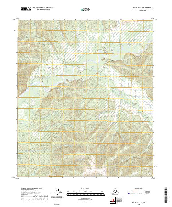
2024 Map of Big Delta C-5 SE
USGS Topo · Published 2024About this map
The Salcha River meanders across the northern portion of this Fairbanks North Star quadrangle, cutting through a landscape defined by significant elevation changes and intricate water systems. This interior Alaskan terrain is drained by several named tributaries, including Flat Creek which flows into the main river from the south. The southern half of the map is dominated by higher ridges where the headwaters of Twentyfive-Mile Creek, Lenant Creek, and Uncle Sam Creek originate. The topography reflects the remote character of the Tanana Valley watershed, showing a complex network of drainages without the presence of established roads or permanent settlements. The map provides a detailed view of the natural watercourses as they existed in the early 21st century, serving as a primary record of this undeveloped wilderness area.
Find a feature on this map
5 named features on this map. Tap any name to fly to it.
Don’t see what you’re looking for? This feature index may not catch every label — zoom into the map to look around manually.
Map Details
Editions of this 2024 Big Delta C-5 SE Map
This is the sole edition of this map. No revisions or reprints were ever made.
Other maps of this area

1949 · Big Delta B-5
USGS Topo · 1:63,360

1950 · Big Delta
USGS Topo · 1:250,000

1950 · Big Delta B-4
USGS Topo · 1:63,360

1951 · Big Delta
USGS Topo · 1:250,000

1952 · Big Delta B-5
USGS Topo · 1:63,360

1953 · Big Delta B-4
USGS Topo · 1:63,360

1958 · Big Delta C-5
USGS Topo · 1:63,360

1958 · Big Delta C-4
USGS Topo · 1:63,360

1958 · Big Delta
USGS Topo · 1:250,000
2016 · Big Delta C-5 NW
USGS Topo · 1:25,000