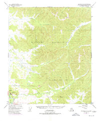
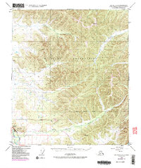
1949 Map of Big Delta C-6
USGS Topo · Published 1977About this map
The Trans-Alaska Pipeline cuts a distinct path through the Interior Alaska landscape in this 1975 revision, noted as being under construction at the time. The line runs southeast through the drainage of the Little Salcha River, passing a dedicated Pumping Station and crossing the Richardson Highway corridor. This era marks a significant industrial transition for the region, as the massive infrastructure project was integrated into a terrain defined by older geographic landmarks like VABM 1831 Ganyon and VABM 2566 Seven.
Find a feature on this map
19 named features on this map. Tap any name to fly to it.
Don’t see what you’re looking for? This feature index may not catch every label — zoom into the map to look around manually.
Map Details
Editions of this 1949 Big Delta C-6 Map
6 editions found
Other maps of this area

1949 · Fairbanks D-1
USGS Topo · 1:62,500

1949 · Big Delta B-5
USGS Topo · 1:63,360

1949 · Big Delta B-6
USGS Topo · 1:63,360

1949 · Fairbanks C-1
USGS Topo · 1:63,360

1949 · Big Delta C-6
USGS Topo · 1:63,360

1950 · Fairbanks
USGS Topo · 1:250,000

1950 · Big Delta
USGS Topo · 1:250,000

1950 · Big Delta D-6
USGS Topo · 1:63,360

1950 · Fairbanks C-1
USGS Topo · 1:63,360

1950 · Fairbanks B-1
USGS Topo · 1:63,360