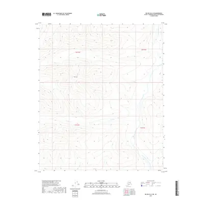
2018 Map of Big Delta D-2 NE
USGS Topo · Published 2018About this map
West Point dominates the central high ground of this interior Alaska landscape, serving as a primary landmark in a region defined by its complex drainage patterns. The Salcha River winds through the eastern portion of the territory, carving a distinct valley that contrasts with the surrounding uplands. This 2018 survey reveals a terrain largely shaped by natural watercourses like Boulder Cr, which cuts across the southern sections of the quadrangle. The lack of established roads or settlements suggests a wilderness area primarily utilized for seasonal subsistence or remote exploration. The map provides a precise look at the township and range boundaries, including t2n r15e and t1n r16e, which organize this portion of the Fairbanks North Star Borough. For those studying the hydrology of the Tanana Valley watershed, the intricate contour work illustrates the relationship between the elevated peaks and the river systems that drain them.
Find a feature on this map
7 named features on this map. Tap any name to fly to it.
Don’t see what you’re looking for? This feature index may not catch every label — zoom into the map to look around manually.
Map Details
Editions of this 2018 Big Delta D-2 NE Map
This is the sole edition of this map. No revisions or reprints were ever made.
Other maps of this area

1950 · Big Delta
USGS Topo · 1:250,000

1951 · Big Delta
USGS Topo · 1:250,000

1951 · Circle
USGS Topo · 1:250,000

1955 · Circle A-2
USGS Topo · 1:63,360

1955 · Circle A-1
USGS Topo · 1:63,360

1955 · Circle
USGS Topo · 1:250,000

1958 · Big Delta D-2
USGS Topo · 1:63,360

1958 · Big Delta D-1
USGS Topo · 1:63,360

1958 · Big Delta
USGS Topo · 1:250,000

1964 · Circle
USGS Topo · 1:250,000