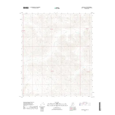
2018 Map of Big Delta D-2 NW
USGS Topo · Published 2018About this map
The N Fork Salcha River winds through the northern and western sections of this Fairbanks North Star Borough landscape, defining a high-elevation interior Alaskan environment. This 2018 topographic study focuses on a largely undeveloped region within several township and range boundaries, including t2n r14e and t1n r14e. The terrain is dominated by complex ridge systems and steep valleys typical of the Yukon-Tanana Upland, where water features like Boulder Cr have carved narrow drainages into the high ground. The mapping reflects a moment of modern natural-state documentation, showing the intricate contour intervals of the Tanana River watershed before significant human infrastructure reached this specific interior corridor. Researchers and land historians can use these elevations to understand the hydrology and drainage patterns that dictate the movement of water across the northern reaches of the Salcha River basin.
Find a feature on this map
7 named features on this map. Tap any name to fly to it.
Don’t see what you’re looking for? This feature index may not catch every label — zoom into the map to look around manually.
Map Details
Editions of this 2018 Big Delta D-2 NW Map
This is the sole edition of this map. No revisions or reprints were ever made.
Other maps of this area

1950 · Big Delta
USGS Topo · 1:250,000

1951 · Big Delta
USGS Topo · 1:250,000

1951 · Circle
USGS Topo · 1:250,000

1955 · Circle A-2
USGS Topo · 1:63,360

1955 · Circle A-3
USGS Topo · 1:63,360

1955 · Circle
USGS Topo · 1:250,000

1958 · Big Delta D-3
USGS Topo · 1:63,360

1958 · Big Delta D-2
USGS Topo · 1:63,360

1958 · Big Delta
USGS Topo · 1:250,000

1964 · Circle
USGS Topo · 1:250,000