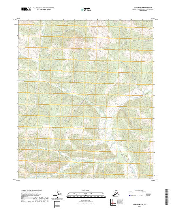
2024 Map of Big Delta D-3 SW
USGS Topo · Published 2024About this map
North Fork Salcha River winds through this interior Alaskan landscape, defining the central drainage pattern for a region characterized by significant topographic relief. In the northern reaches, Gold Creek flows westward, while the southern boundary of the quadrangle is marked by the course of Bonanza Creek. This 2024 survey reflects the modern geospatial record of the Fairbanks North Star Borough, emphasizing the natural hydrology and elevation of the territory rather than human infrastructure or developed settlements. The map provides a clear look at the intersection of several townships, including t1n r11e, t1n r12e, and t2s r12e, documenting the land divisions used for surveying this remote portion of the Alaskan interior.
Find a feature on this map
9 named features on this map. Tap any name to fly to it.
Don’t see what you’re looking for? This feature index may not catch every label — zoom into the map to look around manually.
Map Details
Editions of this 2024 Big Delta D-3 SW Map
This is the sole edition of this map. No revisions or reprints were ever made.
Other maps of this area

1950 · Big Delta
USGS Topo · 1:250,000

1951 · Big Delta
USGS Topo · 1:250,000

1958 · Big Delta C-4
USGS Topo · 1:63,360

1958 · Big Delta D-4
USGS Topo · 1:63,360

1958 · Big Delta C-3
USGS Topo · 1:63,360

1958 · Big Delta D-3
USGS Topo · 1:63,360

1958 · Big Delta
USGS Topo · 1:250,000
1973 · Big Delta D-3
USGS Topo · 1:63,360
2016 · Big Delta D-4 SE
USGS Topo · 1:25,000
2016 · Big Delta D-3 NW
USGS Topo · 1:25,000