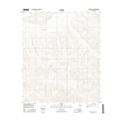
2016 Map of Big Delta D-4 NE
USGS Topo · Published 2016About this map
The Middle Fork Chena River cuts through this remote interior Alaskan landscape, which is defined by a dense network of high-elevation drainages. This 2016 survey documents the complex topography within the Fairbanks North Star Borough, where significant elevation changes shape the paths of waterways like Blackshell Cr and Teuchet Cr. The map is organized by the Public Land Survey System, showing sections across t2n r10e, t2n r11e, t1n r10e, and t1n r11e. Other notable tributaries including Lohi Cr, Anderson Cr, and Ottertail Cr highlight the region's hydrography. Without any roads or settlements printed on the sheet, the map serves as a primary record of the natural terrain and water systems that dominate this wilderness area east of Fairbanks.
Find a feature on this map
10 named features on this map. Tap any name to fly to it.
Don’t see what you’re looking for? This feature index may not catch every label — zoom into the map to look around manually.
Map Details
Editions of this 2016 Big Delta D-4 NE Map
This is the sole edition of this map. No revisions or reprints were ever made.
Other maps of this area

1950 · Big Delta
USGS Topo · 1:250,000

1951 · Big Delta
USGS Topo · 1:250,000

1951 · Circle
USGS Topo · 1:250,000

1952 · Circle A-4
USGS Topo · 1:63,360

1955 · Circle A-3
USGS Topo · 1:63,360

1955 · Circle
USGS Topo · 1:250,000

1958 · Big Delta D-4
USGS Topo · 1:63,360

1958 · Big Delta D-3
USGS Topo · 1:63,360

1958 · Big Delta
USGS Topo · 1:250,000

1964 · Circle
USGS Topo · 1:250,000