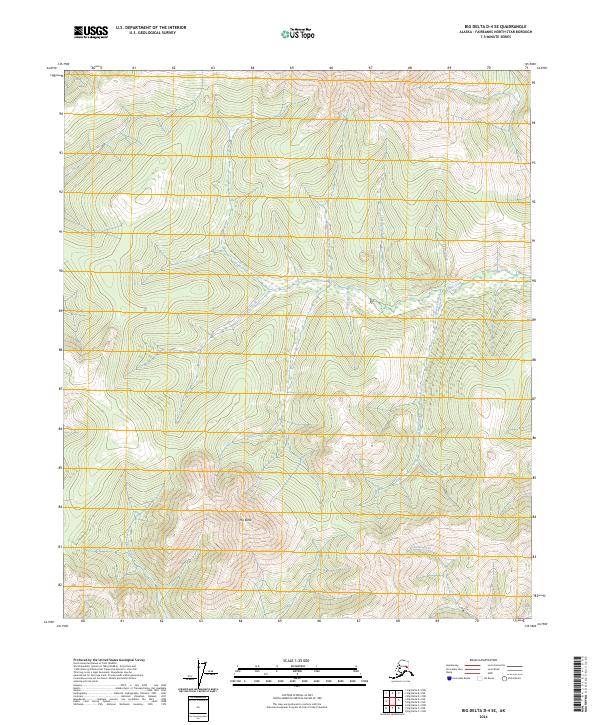
2024 Map of Big Delta D-4 SE
USGS Topo · Published 2024About this map
The Butte rises as a central topographic anchor within this interior Alaskan landscape, which is defined by an intricate network of waterways named for their mineral associations. The drainage patterns of Gold Creek, Quartz Creek, and Bonanza Creek suggest a terrain historically explored for its geological potential. These streams carve through the wilderness of the Fairbanks North Star Borough, converging into larger systems like Bluestone Creek and Graystone Creek.
Find a feature on this map
17 named features on this map. Tap any name to fly to it.
Don’t see what you’re looking for? This feature index may not catch every label — zoom into the map to look around manually.
Map Details
Editions of this 2024 Big Delta D-4 SE Map
This is the sole edition of this map. No revisions or reprints were ever made.
Other maps of this area

1950 · Big Delta
USGS Topo · 1:250,000

1951 · Big Delta
USGS Topo · 1:250,000

1958 · Big Delta C-4
USGS Topo · 1:63,360

1958 · Big Delta D-4
USGS Topo · 1:63,360

1958 · Big Delta C-3
USGS Topo · 1:63,360

1958 · Big Delta D-3
USGS Topo · 1:63,360

1958 · Big Delta
USGS Topo · 1:250,000
1973 · Big Delta D-3
USGS Topo · 1:63,360
2016 · Big Delta D-4 SE
USGS Topo · 1:25,000
2016 · Big Delta D-3 NW
USGS Topo · 1:25,000