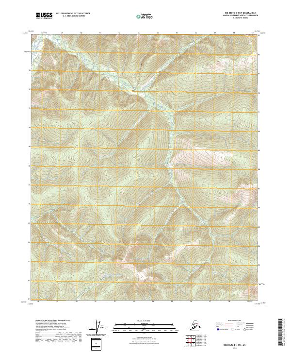
2024 Map of Big Delta D-4 SW
USGS Topo · Published 2024About this map
South Fork Chena River winds through the southern reaches of this interior Alaskan landscape, serving as a primary drainage for the surrounding high country. The terrain is defined by its network of narrow valleys and ridges, with Munson Creek flowing northward to join other tributaries. Higher elevations are marked by the headwaters of Wheeler Creek and Anderson Creek, illustrating a classic drainage pattern of the Fairbanks North Star region. The lack of modern road infrastructure underscores the wilderness character of this area, where land is primarily delineated by township and range lines like t1n r9e and t1s r10e. This map provides a clear record of the hydrography and topography before significant human alteration, capturing the pristine state of the watershed.
Find a feature on this map
11 named features on this map. Tap any name to fly to it.
Don’t see what you’re looking for? This feature index may not catch every label — zoom into the map to look around manually.
Map Details
Editions of this 2024 Big Delta D-4 SW Map
This is the sole edition of this map. No revisions or reprints were ever made.
Other maps of this area

1950 · Big Delta
USGS Topo · 1:250,000

1951 · Big Delta
USGS Topo · 1:250,000

1958 · Big Delta C-5
USGS Topo · 1:63,360

1958 · Big Delta D-5
USGS Topo · 1:63,360

1958 · Big Delta C-4
USGS Topo · 1:63,360

1958 · Big Delta D-4
USGS Topo · 1:63,360

1958 · Big Delta
USGS Topo · 1:250,000
2016 · Big Delta D-4 SE
USGS Topo · 1:25,000
2016 · Big Delta C-5 NE
USGS Topo · 1:25,000
2016 · Big Delta D-4 SW
USGS Topo · 1:25,000