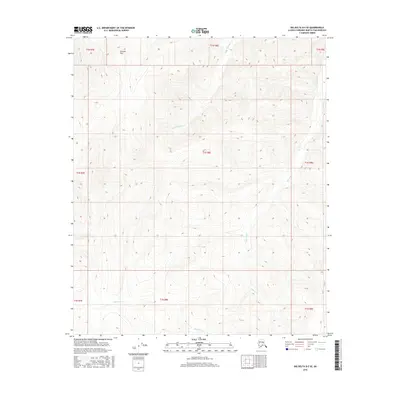
2016 Map of Big Delta D-5 SE
USGS Topo · Published 2016About this map
Granite Tors dominates the high-latitude terrain within the Fairbanks North Star Borough, as shown in this 2016 topographic study. This specific corner of the interior landscape is defined by its complex drainage systems, where Little Munson Cr and Rock Cr carve through the northern sections while Wheeler Cr flows southward across the central townships. The drainage patterns and the presence of the Tors imply a landscape of resistant rock formations and significant elevation changes, characteristic of the uplands northeast of the Tanana River valley. Boundary markers for several townships, including t1n r8e and t1s r8e, help orient researchers within this largely uninhabited wilderness, while Beaver Cr skirts the southern edge of the survey area, marking the low-lying extent of the local watershed.
Find a feature on this map
14 named features on this map. Tap any name to fly to it.
Don’t see what you’re looking for? This feature index may not catch every label — zoom into the map to look around manually.
Map Details
Editions of this 2016 Big Delta D-5 SE Map
This is the sole edition of this map. No revisions or reprints were ever made.
Other maps of this area

1950 · Big Delta
USGS Topo · 1:250,000

1951 · Big Delta
USGS Topo · 1:250,000

1958 · Big Delta C-5
USGS Topo · 1:63,360

1958 · Big Delta D-5
USGS Topo · 1:63,360

1958 · Big Delta C-4
USGS Topo · 1:63,360

1958 · Big Delta D-4
USGS Topo · 1:63,360

1958 · Big Delta
USGS Topo · 1:250,000
2016 · Big Delta C-5 NW
USGS Topo · 1:25,000
2016 · Big Delta C-5 NE
USGS Topo · 1:25,000
2016 · Big Delta D-5 SW
USGS Topo · 1:25,000