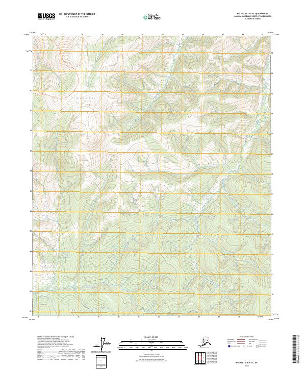
2024 Map of Big Delta D-5 SE
USGS Topo · Published 2024About this map
Granite Tors rises as a prominent geological landmark in this interior Alaskan wilderness, characterized by distinctive rock formations that dominate the high ridges. The landscape is defined by its complex drainage network, where Beaver Creek meanders through the southern lowlands. These watercourses, including Rock Creek and Little Munson Creek, dictate the movement across the varied terrain of the Fairbanks North Star Borough. The map reveals a wild, undeveloped expanse within the t1n r8e and t1s r8e townships, showcasing the natural state of the northern interior before the influence of heavy modern infrastructure. Researchers can trace the elevation changes and seasonal water flow of Wheeler Creek as it cuts through the northern sections of this topographic study.
Find a feature on this map
14 named features on this map. Tap any name to fly to it.
Don’t see what you’re looking for? This feature index may not catch every label — zoom into the map to look around manually.
Map Details
Editions of this 2024 Big Delta D-5 SE Map
This is the sole edition of this map. No revisions or reprints were ever made.
Other maps of this area

1950 · Big Delta
USGS Topo · 1:250,000

1951 · Big Delta
USGS Topo · 1:250,000

1958 · Big Delta C-5
USGS Topo · 1:63,360

1958 · Big Delta D-5
USGS Topo · 1:63,360

1958 · Big Delta C-4
USGS Topo · 1:63,360

1958 · Big Delta D-4
USGS Topo · 1:63,360

1958 · Big Delta
USGS Topo · 1:250,000
2016 · Big Delta C-5 NW
USGS Topo · 1:25,000
2016 · Big Delta C-5 NE
USGS Topo · 1:25,000
2016 · Big Delta D-5 SW
USGS Topo · 1:25,000