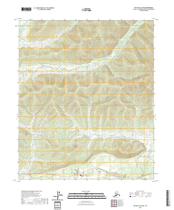
2024 Map of Big Delta D-6 NW
USGS Topo · Published 2024About this map
Two Rivers and Pleasant Valley anchor the southern landscape of this Fairbanks North Star Borough quadrangle, where residential development clusters along the vital Chena Hot Springs Road corridor. The layout of the modern road network, including Pheasant Farm Rd and Joyce Jean Drive, contrasts with the remote wilderness to the north. Local history is grounded at the Pleasant Valley Cem, while the interior terrain is defined by a series of significant drainage basins, notably Anaconda Creek and Caribou Creek. The presence of the Chena Hot Springs Winter Trl suggests the historical and seasonal importance of this route through the interior, connecting these valley settlements to the broader Alaskan wilderness. Smaller waterways like Flat Creek and Jenny M Creek further dissect the land, illustrating the complex hydrology of the Tanana Valley region.
Find a feature on this map
21 named features on this map. Tap any name to fly to it.
Don’t see what you’re looking for? This feature index may not catch every label — zoom into the map to look around manually.
Map Details
Editions of this 2024 Big Delta D-6 NW Map
This is the sole edition of this map. No revisions or reprints were ever made.
Other maps of this area

1945 · Livengood
USGS Topo · 1:250,000

1949 · Fairbanks D-1
USGS Topo · 1:62,500

1950 · Fairbanks
USGS Topo · 1:250,000

1950 · Big Delta
USGS Topo · 1:250,000

1950 · Big Delta D-6
USGS Topo · 1:63,360

1951 · Big Delta
USGS Topo · 1:250,000

1951 · Fairbanks
USGS Topo · 1:250,000

1951 · Livengood
USGS Topo · 1:250,000

1951 · Circle
USGS Topo · 1:250,000

1952 · Big Delta D-6
USGS Topo · 1:63,360