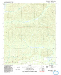
1992 Map of Big Delta D-6 NW
USGS Topo · Published 1992About this map
The Chena River corridor and its surrounding tributaries define this interior Alaskan landscape as it was documented in the early 1990s. The southern reaches of the map are dominated by the Chena River State Recreation Area, where the Chena Hot Springs Road provides the primary access to the thermal waters of Chena Hot Springs and nearby campgrounds. This area serves as a critical transition between the valley floor and the higher terrain of Tract A and Tract B.
Find a feature on this map
17 named features on this map. Tap any name to fly to it.
Don’t see what you’re looking for? This feature index may not catch every label — zoom into the map to look around manually.
Map Details
Editions of this 1992 Big Delta D-6 NW Map
This is the sole edition of this map. No revisions or reprints were ever made.
Other maps of this area

1945 · Livengood
USGS Topo · 1:250,000

1949 · Fairbanks D-1
USGS Topo · 1:62,500

1950 · Fairbanks
USGS Topo · 1:250,000

1950 · Big Delta
USGS Topo · 1:250,000

1950 · Big Delta D-6
USGS Topo · 1:63,360

1951 · Big Delta
USGS Topo · 1:250,000

1951 · Fairbanks
USGS Topo · 1:250,000

1951 · Livengood
USGS Topo · 1:250,000

1951 · Circle
USGS Topo · 1:250,000

1952 · Big Delta D-6
USGS Topo · 1:63,360