Loading...
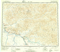
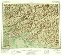
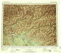
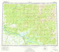
Loading map...1950 Map of Big Delta
USGS Topo · Published 1956About this map
Big Delta and the confluence of the Tanana River and Delta River serve as the anchor for this 1950 interior Alaska survey. The landscape is defined by the Richardson Highway corridor, which links small outposts and roadside stops like Richardson, Buffalo Center, and Aurora Lodge. Military activity is prominent in the southern half of the map, marked by the extensive Ladd Air Force Base Bombing and Gunnery Range and the installation at Fort Greely.
Find a feature on this map
111 named features on this map. Tap any name to fly to it.
Don’t see what you’re looking for? This feature index may not catch every label — zoom into the map to look around manually.
Map Details
Date Portrayed1950
Date Published1956
PublisherU.S. Geological Survey
Map TypeTopographic
Scale1:250,000
Physical Dimensions25.4 x 22 inches
Editions of this 1950 Big Delta Map
2 editions found
Historical Maps of Delta Junction Through Time
3 maps found
Featured Locations
Source Details
SourceU.S. Geological Survey
CopyrightPublic Domain