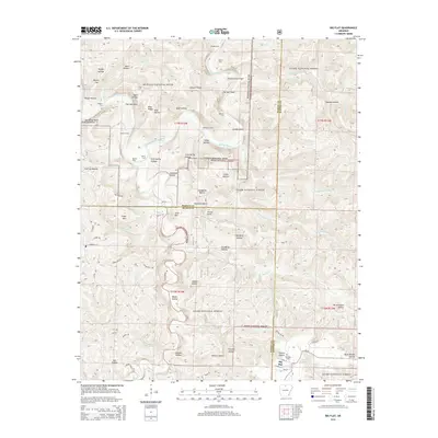
2014 Map of Big Flat
USGS Topo · Published 2014About this map
The Big Flat settlement sits at the intersection of Arkansas Highway 14 and Cozahome Road, serving as a central point in this northern Arkansas landscape. Much of the northern terrain is dedicated to the Buffalo National River, where the waterway winds past notable river crossings and hazards such as Shields Ford, Fishtrap Shoal, and Leatherwood Shoal. To the south and east, the Ozark National Forest covers extensive ridges and hollows, including Woods Hollow and Cap Berry Hollow. For those researching local roots, the Big Flat Cemetery is documented near the town center. The map reveals a network of rural roads like Huckleberry Road and Dry Branch Road that provide access to the various peaks and knobs, including Suggs Mountain and Almus Knob.
Find a feature on this map
77 named features on this map. Tap any name to fly to it.
Don’t see what you’re looking for? This feature index may not catch every label — zoom into the map to look around manually.
Map Details
Editions of this 2014 Big Flat Map
This is the sole edition of this map. No revisions or reprints were ever made.
Other maps of this area

1890 · Mountain Home
USGS Topo · 1:125,000

1891 · Mountain Home
USGS Topo · 1:125,000

1892 · Marshall
USGS Topo · 1:125,000

1892 · Mountain View
USGS Topo · 1:125,000

1893 · Yellville
USGS Topo · 1:125,000

1894 · Mountain View
USGS Topo · 1:125,000

1894 · Mountain Home
USGS Topo · 1:125,000

1894 · Marshall
USGS Topo · 1:125,000

1901 · Marshall
USGS Topo · 1:125,000

1903 · Yellville
USGS Topo · 1:125,000