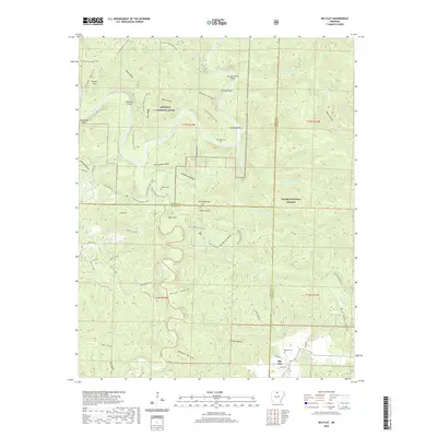
2020 Map of Big Flat
USGS Topo · Published 2020About this map
Big Flat stands at the intersection of several county boundaries, where the Ozark highlands drop toward the winding corridor of the Buffalo National River. The landscape is defined by its dramatic relief, carved by numerous tributaries such as Middle Creek and Spring Creek that feed into the larger river system. Navigation through this complex terrain is provided by a network of rural routes like Searcy 156 Hwy and historical paths including the N Lower Wilderness Trails.
Find a feature on this map
74 named features on this map. Tap any name to fly to it.
Don’t see what you’re looking for? This feature index may not catch every label — zoom into the map to look around manually.
Map Details
Editions of this 2020 Big Flat Map
This is the sole edition of this map. No revisions or reprints were ever made.
Other maps of this area

1890 · Mountain Home
USGS Topo · 1:125,000

1891 · Mountain Home
USGS Topo · 1:125,000

1892 · Marshall
USGS Topo · 1:125,000

1892 · Mountain View
USGS Topo · 1:125,000

1893 · Yellville
USGS Topo · 1:125,000

1894 · Mountain View
USGS Topo · 1:125,000

1894 · Mountain Home
USGS Topo · 1:125,000

1894 · Marshall
USGS Topo · 1:125,000

1901 · Marshall
USGS Topo · 1:125,000

1903 · Yellville
USGS Topo · 1:125,000