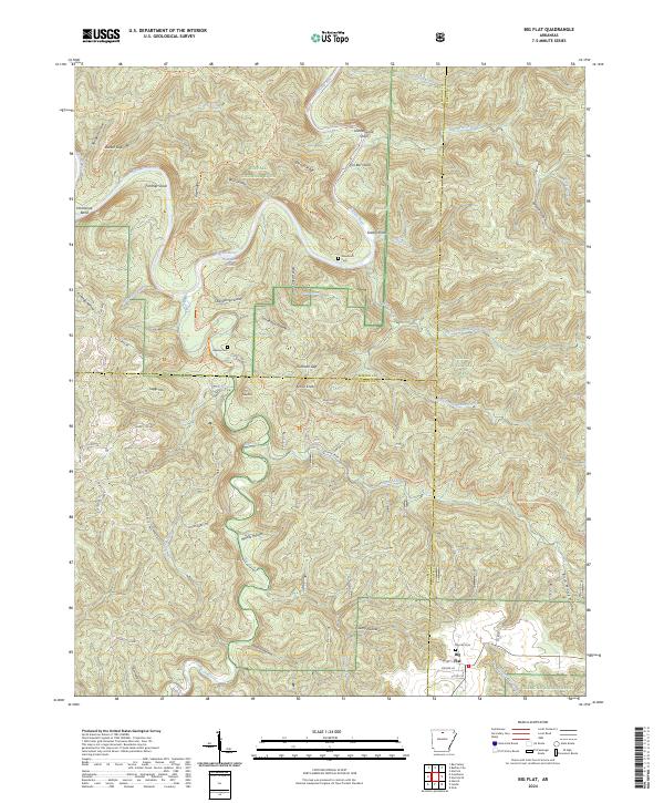
2024 Map of Big Flat
USGS Topo · Published 2024About this map
The town of Big Flat serves as the primary settlement in this corner of the Ozarks, positioned where the boundaries of Marion, Searcy, and Baxter counties meet. The landscape is defined by the winding course of the Buffalo National River, which carves through the northern portion of the map. This area is characterized by steep topography and numerous hollows such as Loonbeam Hollow and Vickery Hollow, alongside prominent peaks like Almus Knob and Suggs Mtn.
Find a feature on this map
76 named features on this map. Tap any name to fly to it.
Don’t see what you’re looking for? This feature index may not catch every label — zoom into the map to look around manually.
Map Details
Editions of this 2024 Big Flat Map
This is the sole edition of this map. No revisions or reprints were ever made.
Other maps of this area

1890 · Mountain Home
USGS Topo · 1:125,000

1891 · Mountain Home
USGS Topo · 1:125,000

1892 · Marshall
USGS Topo · 1:125,000

1892 · Mountain View
USGS Topo · 1:125,000

1893 · Yellville
USGS Topo · 1:125,000

1894 · Mountain View
USGS Topo · 1:125,000

1894 · Mountain Home
USGS Topo · 1:125,000

1894 · Marshall
USGS Topo · 1:125,000

1901 · Marshall
USGS Topo · 1:125,000

1903 · Yellville
USGS Topo · 1:125,000