1971 Map of Big Flat West
USGS Topo · Published 1975About this map
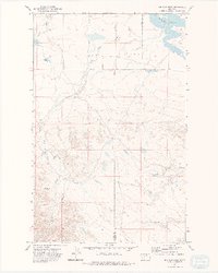
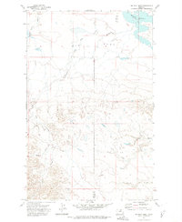
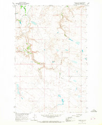
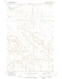
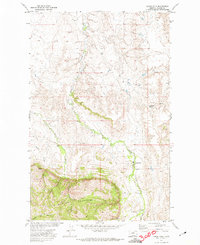
Big Flat dominates this high-plains landscape within the boundary of the Fort Belknap Indian Reservation, where the drainage patterns of North Central Montana are clearly defined. In the northern reaches, the Weigand Reservoir serves as a significant catchment point, while the rest of the terrain is deeply etched by a network of seasonal watercourses. The drainage system is characterized by the branching paths of Lone Tree Coulee, Corral Coulee, and Chicken Coulee, which illustrate the erosion patterns typical of this semi-arid region. Mapping conducted by the Geological Survey during the early 1970s reveals a sparse road network and the political division between Blaine Co and Phillips Co. The southern portion of the sheet is particularly intricate, showing the converging paths of Wolf, Allen, and Rocky Coulee as they traverse the elevated plateau.
Find a feature on this map
9 named features on this map. Tap any name to fly to it.
Don’t see what you’re looking for? This feature index may not catch every label — zoom into the map to look around manually.
Map Details
Editions of this 1971 Big Flat West Map
2 editions found
Other maps of this area

1953 · Havre
USGS Topo · 1:250,000

1957 · Havre
USGS Topo · 1:250,000

1958 · Havre
USGS Topo · 1:250,000
1964 · Coburg SE
USGS Topo · 1:24,000

1964 · Weigand Reservoir
USGS Topo · 1:24,000
1971 · Big Flat East
USGS Topo · 1:24,000

1971 · Lodge Pole NE
USGS Topo · 1:24,000
1971 · Lodge Pole
USGS Topo · 1:24,000
1971 · Bigby Lake
USGS Topo · 1:24,000
1971 · Ball Coulee
USGS Topo · 1:24,000