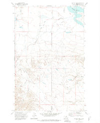
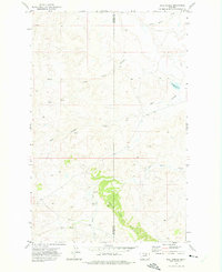
1971 Map of Big Flat West
USGS Topo · Published 1975About this map
Big Flat dominates this 1970s landscape along the border of Blaine and Phillips Counties. The terrain is defined by a series of deep drainage channels known as coulees that carve through the plateau. In the northeast, the Weigand Reservoir provides a significant water source, while the surrounding land is marked by the winding paths of Lone Tree Coulee, Chicken Coulee, and Rocky Coulee.
Find a feature on this map
9 named features on this map. Tap any name to fly to it.
Don’t see what you’re looking for? This feature index may not catch every label — zoom into the map to look around manually.
Map Details
Editions of this 1971 Big Flat West Map
2 editions found
Other maps of this area

1953 · Havre
USGS Topo · 1:250,000

1957 · Havre
USGS Topo · 1:250,000

1958 · Havre
USGS Topo · 1:250,000

1964 · Coburg SE
USGS Topo · 1:24,000

1964 · Weigand Reservoir
USGS Topo · 1:24,000

1971 · Big Flat East
USGS Topo · 1:24,000

1971 · Lodge Pole NE
USGS Topo · 1:24,000
1971 · Lodge Pole
USGS Topo · 1:24,000
1971 · Bigby Lake
USGS Topo · 1:24,000
1971 · Ball Coulee
USGS Topo · 1:24,000