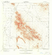
1918 Map of Big Hatchet Peak
USGS Topo · Published 1937About this map
Big Hatchet Peak dominates the center of this 1918 landscape, a period when this high desert corner of New Mexico was defined by isolated cattle ranches and critical water sources. The map details a network of family-held properties including Lanes Ranch, Lambert Ranch, and Dallas Hatchet Ranch, each strategically positioned near breaks in the terrain like Hatchet Gap. The reliance on groundwater is evident through the numerous named wells and springs such as Sheridan Wells and Las Cienegas Spring, which supported the livestock economy in the broad Hachita Valley.
Find a feature on this map
38 named features on this map. Tap any name to fly to it.
Don’t see what you’re looking for? This feature index may not catch every label — zoom into the map to look around manually.
Map Details
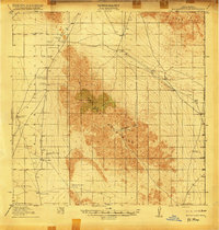
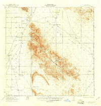
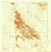
Editions of this 1918 Big Hatchet Peak Map
5 editions found
Other maps of this area

1917 · Antelope Wells
USGS Topo · 1:62,500

1918 · Big Hatchet Peak
USGS Topo · 1:62,500

1918 · Hachita
USGS Topo · 1:62,500

1918 · Dog Mountains
USGS Topo · 1:62,500

1918 · Walnut Wells
USGS Topo · 1:62,500

1918 · Victorio
USGS Topo · 1:62,500

1918 · Playas
USGS Topo · 1:62,500

1919 · Playas
USGS Topo · 1:62,500

1919 · Antelope Wells
USGS Topo · 1:62,500

1923 · Walnut Wells
USGS Topo · 1:62,500