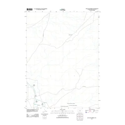
2012 Map of Big Island Bridge
USGS Topo · Published 2012About this map
The historic Emigrant Trl cuts across this Wyoming landscape, marking a legacy of westward passage through the high plains. Situated in Sweetwater County, the area is defined by the winding course of the Green River, which surrounds the distinctive Big Island. This river system is a critical focal point for the region, supported by local infrastructure like the Big Island Bridge and the Big Island Rd, providing access across the complex network of drainage features such as East Otterson Wash and Big Island Wash.
Find a feature on this map
13 named features on this map. Tap any name to fly to it.
Don’t see what you’re looking for? This feature index may not catch every label — zoom into the map to look around manually.
Map Details
Editions of this 2012 Big Island Bridge Map
This is the sole edition of this map. No revisions or reprints were ever made.
Other maps of this area

1954 · Rock Springs
USGS Topo · 1:250,000

1958 · Rock Springs
USGS Topo · 1:250,000

1961 · Blue Point
USGS Topo · 1:24,000

1961 · Austin Ranch
USGS Topo · 1:24,000

1961 · Stevens Flat
USGS Topo · 1:24,000

1962 · Rock Springs
USGS Topo · 1:250,000

1963 · Gasson Bridge
USGS Topo · 1:24,000

1963 · Pittman Well
USGS Topo · 1:24,000

1963 · Big Island Bridge
USGS Topo · 1:24,000
1963 · Thoman School
USGS Topo · 1:24,000