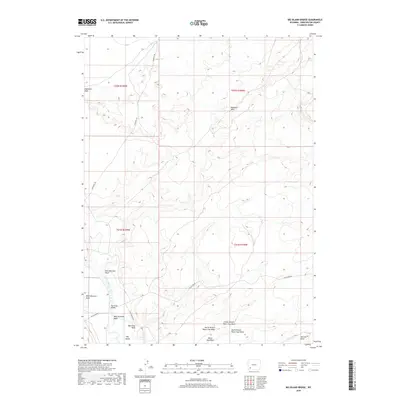
2018 Map of Big Island Bridge
USGS Topo · Published 2018About this map
The Green River carves a path through this arid landscape, defining the boundaries of the Big Island and the surrounding high plains. In this part of Sweetwater County, the land is marked by significant topographical shifts, from the deeply eroded Badlands Hills to the broad expanses of Stevens Flat. The network of watercourses, including Eightmile Wash, East Otterson Wash, and Water Gap Wash, underscores the importance of drainage and seasonal water flow in this high-desert environment.
Find a feature on this map
27 named features on this map. Tap any name to fly to it.
Don’t see what you’re looking for? This feature index may not catch every label — zoom into the map to look around manually.
Map Details
Editions of this 2018 Big Island Bridge Map
This is the sole edition of this map. No revisions or reprints were ever made.
Other maps of this area

1954 · Rock Springs
USGS Topo · 1:250,000

1958 · Rock Springs
USGS Topo · 1:250,000

1961 · Blue Point
USGS Topo · 1:24,000

1961 · Austin Ranch
USGS Topo · 1:24,000

1961 · Stevens Flat
USGS Topo · 1:24,000

1962 · Rock Springs
USGS Topo · 1:250,000

1963 · Gasson Bridge
USGS Topo · 1:24,000

1963 · Pittman Well
USGS Topo · 1:24,000

1963 · Big Island Bridge
USGS Topo · 1:24,000
1963 · Thoman School
USGS Topo · 1:24,000