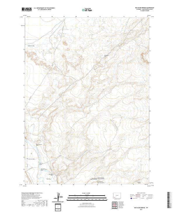
2021 Map of Big Island Bridge
USGS Topo · Published 2021About this map
The Green River carves through the southwestern corner of this Sweetwater County landscape, defined by a network of drainage washes and historical transit routes. The Big Island Bridge provides a vital crossing point near the settlement of Big Island, where the river splits around its namesake landform. This area serves as a significant corridor for both modern and historical travel, notably where the Emigrant Trl winds across the northern terrain. Movement through the region is further traced by Big Island Rd and Old Stauffer Rd, which connect the river valley to the surrounding uplands. Away from the water, the topography rises into the Badlands Hills, a series of stark formations drained by seasonal features like Eightmile Wash and East Otterson Wash. Local topography is further marked by Stevens Draw and the various branches of the Water Gap Wash.
Find a feature on this map
20 named features on this map. Tap any name to fly to it.
Don’t see what you’re looking for? This feature index may not catch every label — zoom into the map to look around manually.
Map Details
Editions of this 2021 Big Island Bridge Map
This is the sole edition of this map. No revisions or reprints were ever made.
Other maps of this area

1954 · Rock Springs
USGS Topo · 1:250,000

1958 · Rock Springs
USGS Topo · 1:250,000

1961 · Blue Point
USGS Topo · 1:24,000

1961 · Austin Ranch
USGS Topo · 1:24,000

1961 · Stevens Flat
USGS Topo · 1:24,000

1962 · Rock Springs
USGS Topo · 1:250,000

1963 · Gasson Bridge
USGS Topo · 1:24,000

1963 · Pittman Well
USGS Topo · 1:24,000

1963 · Big Island Bridge
USGS Topo · 1:24,000
1963 · Thoman School
USGS Topo · 1:24,000