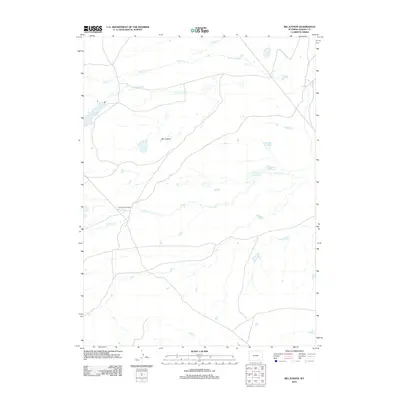
2012 Map of Big Judson
USGS Topo · Published 2012About this map
Big Judson and the Old Northrup Ranch anchor this Albany County landscape, illustrating the enduring agricultural and ranching heritage of this high plains region. The map highlights a complex irrigation system vital for livestock and hay production, featuring King Ditch Number 1 and King Ditch Number 2, which divert water across the drainage basins. Water management is a primary focus, with several significant impoundments including Dutton Creek Reservoir and Cavender Reservoir situated along the winding paths of Dutton Cr and Cooper Cr. This U.S. Geological Survey representation reflects the modern rural infrastructure of the area, where sparse settlements are connected by a network of local roads and unimproved trails that follow the natural topography and the flow of the local creeks.
Find a feature on this map
8 named features on this map. Tap any name to fly to it.
Don’t see what you’re looking for? This feature index may not catch every label — zoom into the map to look around manually.
Map Details
Editions of this 2012 Big Judson Map
This is the sole edition of this map. No revisions or reprints were ever made.
Other maps of this area

1895 · Laramie
USGS Topo · 1:125,000

1902 · Laramie
USGS Topo · 1:125,000

1905 · Laramie
USGS Topo · 1:125,000

1906 · Medicine Bow
USGS Topo · 1:125,000

1906 · Laramie
USGS Topo · 1:125,000

1908 · Laramie
USGS Topo · 1:125,000

1908 · Medicine Bow
USGS Topo · 1:125,000

1954 · Cheyenne
USGS Topo · 1:250,000

1954 · Rawlins
USGS Topo · 1:250,000

1955 · Big Judson
USGS Topo · 1:24,000