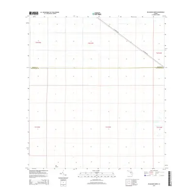
2015 Map of Big Mound North
USGS Topo · Published 2015About this map
Big Mound rises as a subtle landmark in this South Florida landscape, where the flat terrain is strictly divided by the Public Land Survey System. The border between Martin Co and Palm Beach Co cuts straight across the center of the sheet, illustrating the administrative geometry of the region. Transportation in this area is defined by the diagonal path of SW Warfield Blvd, which provides the primary corridor through the grid. The map reveals the extensive drainage and land management patterns typical of this part of Florida, with the landscape segmented into various townships such as t40s r39e and t41s r39e. This 2015 survey reflects the modern configuration of the borderlands between the two counties before further local development.
Find a feature on this map
9 named features on this map. Tap any name to fly to it.
Don’t see what you’re looking for? This feature index may not catch every label — zoom into the map to look around manually.
Map Details
Editions of this 2015 Big Mound North Map
This is the sole edition of this map. No revisions or reprints were ever made.
Other maps of this area

1953 · Okeechobee 4 SE
USGS Topo · 1:24,000

1953 · Indian Town SE
USGS Topo · 1:24,000

1953 · Indian Town
USGS Topo · 1:24,000

1956 · West Palm Beach
USGS Topo · 1:250,000

1956 · Fort Pierce
USGS Topo · 1:250,000

1957 · West Palm Beach
USGS Topo · 1:250,000

1958 · Fort Pierce
USGS Topo · 1:250,000

1958 · West Palm Beach
USGS Topo · 1:250,000

1959 · Fort Pierce
USGS Topo · 1:250,000

1970 · West Palm Beach 2 SW
USGS Topo · 1:24,000