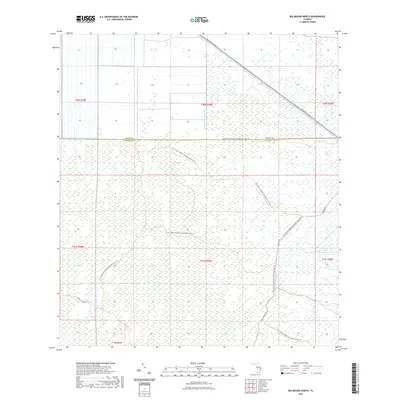
2021 Map of Big Mound North
USGS Topo · Published 2021About this map
Big Mound rises as a prominent landmark in this southern Florida landscape, where the flat wetlands of Palm Beach Co meet the border of Martin Co. This region is defined by extensive conservation and management areas, reflected in the winding paths of the J W Corbett Wildlife Management Area Trl and the Dupuis Reserve Trl. These trails navigate a complex system of marshes and glades that dominate the southern and central portions of the map. In the northern section, human infrastructure becomes more visible with the corridor of SW Warfield Blvd cutting diagonally through the terrain. The map captures the delicate balance between the preserved natural heritage of the Everglades ecosystem and the essential transport routes that skirt its edges, like N Grade Rd.
Find a feature on this map
14 named features on this map. Tap any name to fly to it.
Don’t see what you’re looking for? This feature index may not catch every label — zoom into the map to look around manually.
Map Details
Editions of this 2021 Big Mound North Map
This is the sole edition of this map. No revisions or reprints were ever made.
Other maps of this area

1953 · Okeechobee 4 SE
USGS Topo · 1:24,000

1953 · Indian Town SE
USGS Topo · 1:24,000

1953 · Indian Town
USGS Topo · 1:24,000

1956 · West Palm Beach
USGS Topo · 1:250,000

1956 · Fort Pierce
USGS Topo · 1:250,000

1957 · West Palm Beach
USGS Topo · 1:250,000

1958 · Fort Pierce
USGS Topo · 1:250,000

1958 · West Palm Beach
USGS Topo · 1:250,000

1959 · Fort Pierce
USGS Topo · 1:250,000

1970 · West Palm Beach 2 SW
USGS Topo · 1:24,000